Brazilian farming expands by 95.1 million ha. in 37 years

In 1985, farming occupied a fifth of Brazil's territory, or 187.3 million hectares. In 2022, it reached 282.5 million hectares, which represents a third of the country's land area, according to a survey released by the collaborative network Mapping Annual Land Use and Land Cover in Brazil (MapBiomas). 

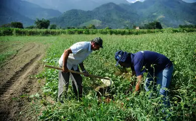
Thus, the expansion over the 37-year period amounted to 95.1 million hectares. Of this total, 58 percent is pastureland, which grew by more than 60 percent between 1985 (103 million hectares) and 2022 (164.3 million hectares). A substantial portion of this growth took place in the Amazon, where pasture areas expanded from 13.7 million hectares in 1985 to a staggering 57.7 million hectares in 2022.
Additionally, agricultural cultivation areas increased by 41.9 million hectares during the period under MapBiomas' analysis. The cultivated land area saw a growth from 19.1 million to 61 million hectares.
Crops
Two key types of crops dominate this expansion, accounting for 96 percent of it: grains and sugar cane. In 1985, these two crop categories covered 18.3 million hectares, but by 2022, their combined area represented 7 percent of the entire national territory, reaching 58.7 million hectares.
Notably, soy and corn played a pivotal role in this expansion, with soy alone quadrupling its cultivated area, often followed by corn crops after the soy harvest, according to findings from MapBiomas researchers.
MapBiomas Coordinator Tasso Azevedo emphasized, "Soy, corn, and sugar cane are the three major crops in Brazil. There is also a very important demand for rice. Their areas reflect the demand for production conditions in the country, with soy primarily used for animal feed and sugar cane catering to the energy sector."
MapBiomas highlighted that the direct conversion of native vegetation into agricultural land has remained relatively stable over the years, with a slight decrease observed between 2018 and 2022.
Another notable observation is the shifting geographical distribution of these conversions, with new agricultural frontiers emerging in Matopiba (an acronym that refers to the states of Maranhão, Tocantins, Piauí, and Bahia), Amacro (the border territory between the states of Amazonas, Acre, and Rondônia, and a major agribusiness hub), and the Pampa biome (located in the southern region of the country).
Significantly, the majority (72.7%) of converted agricultural areas have experienced substantial human intervention, characterized by agricultural intensification, particularly in regions previously designated for pasture.