Brazil lost 2% of its water coverage in 2024

Brazil lost 400 thousand hectares of water surface in 2024, as per an update of the MapBiomas Água time series released Friday (Mar. 21). The country’s territory covered by water bodies and reservoirs came to 17.9 million hectares, down two percent on the 18.3 million recorded in 2023.

According to the new data, there has been an accentuation in the downward trend of this area in the last decade, when eight of the driest years in the time series that began in 1985 were recorded. During this time span, the water surface only saw a recovery in 2022, when it reached 18.8 million hectares.
According to Juliano Schirmbeck, technical coordinator of MapBiomas Água, Brazil is drier as a result of the dynamics of occupation and land use associated with extreme climatic events.
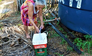
“These data serve as a warning about the need for adaptive water management and public policies to reverse this trend,” he argued.
In 2024, the Amazon registered 10.9 million hectares of water surface—61 percent of the total in Brazil. The Atlantic forest had 2.2 million hectares, or 13 percent of the total; the Pampa 1.8 million hectares, or 10 percent of the total; the cerrado 1.6 million hectares, or nine percent; and the caatinga 981 thousand hectares or five percent of the total.
Water losses
The pantanal, the smallest of Brazil’s six biomes, registered 366 thousand hectares of water surface in 2024, accounting thus for no more than two percent of the country’s total. The biome, however, saw a reduction of 4.1 percent from the previous year and was the most affected by the reduction since 1985, with a loss of 61 percent of the water surface area over those years.
“Since the last flood in 2018, the biome has faced increased spells of drought and, in 2024, the extreme drought increased the incidence and spread of fires,” researcher Eduardo Rosa, from the MapBiomas Água team, pointed out.
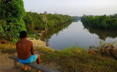
The extreme drought experienced in the Amazon in 2024 also impacted water surfaces in the biome, leading to a reduction of 1.1 million hectares from 2023 and 4.5 million hectares from 2022.
Last year, almost two thirds (63%) of the 47 sub-basins reported a loss of surface water compared to the historical average. Sub-basins of the Negro river have already lost over 50 thousand hectares compared to the historical average.
“There have been two consecutive years of extreme droughts in the Amazon, and in 2024 the drought came earlier and affected basins that were not strongly affected in 2023, such as the Tapajós,” MapBiomas specialist Carlos Souza Jr. remarked.
Water gains
Compared to 2023, the pampa biome remained virtually stable, with a gain of some 100 thousand hectares of area covered by water, still 0.3 percent below its historical average.
This is due to extreme weather conditions, which are seen as the main consequence of the changes caused by global warming, Juliano Schirmbeck said.
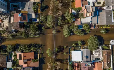
“The pampa had a dry start to the year, with March being the driest month of the year. In the following month and May, there was extreme flooding, reaching the highest monthly surface area in the 40-year time series,” he noted.
Throughout last year, the caatinga, the cerrado and the Atlantic forest remained above the historical average, with the highlight being the caatinga, which ended the year with 6 thousand hectares more than in 2023 and the largest area covered by water in the last 10 years.
According to researcher Diêgo Costa, from MapBiomas' caatinga team, this result indicates the consolidation of a flood cycle for the biome that began in 2018, but caution is needed. “Despite this favorable scenario, areas with recurrent droughts persist, especially along the São Francisco basin and in the Seridó region of the Northeast—territories that are particularly vulnerable to desertification,” he stated.
“Artificial” waters
A phenomenon has been observed in the cerrado: natural water bodies such as rivers and lakes have been replaced by artificial water surfaces such as dams and reservoirs. Over the 40-year time series, the regions where the biome occurs have seen their natural water surfaces reduced from 62 to 40 percent in 2024. Artificial areas rose from 37 to 60 percent last year. As a result, the areas occupied by water in the biome remained unchanged last year.
Overall in Brazil, specialists have observed a historic increase in the surface area of artificial water, with an expansion of 1.5 million hectares over the course of the time series. Among the biomes with the highest concentration of reservoirs and dams are the Atlantic forest (33%) and the cerrado (24%).
Even though they still account for 77 percent of the area covered by water in Brazil, natural bodies of water have been reduced by 15 percent in these 40 years.
In Schirmbeck’s view, the increase in the surface area of water in the cerrado, the caatinga and the Atlantic forest derives from the growth in water stored in hydroelectric dams and other types of reservoirs.