Nearly a quarter of Brazil's territory had wildfires in last 40 years

Nearly a quarter of Brazil's territory caught fire at least once between 1985 and 2023, covering 199.1 million hectares, or 23 percent of the country's land area.

Of the area affected by fire, 68.4 percent was native vegetation, while 31.6 percent was influenced by human activities, particularly farming. The Cerrado and the Amazon are the main biomes impacted by fires, whether natural or man-made, accounting for 86 percent of the burned area.
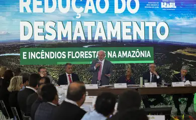
The data, obtained by comparing satellite images, is part of a study released on Tuesday (Jun. 18) by MapBiomas Fogo, a network of universities, non-governmental organizations, and technology companies.
Using satellite images, researchers can analyze the size and historical patterns of the burned areas, but they cannot pinpoint the exact cause of the fires.
However, Ane Alencar, coordinator of MapBiomas Fogo and director of Science at the Amazon Environmental Research Institute (IPAM), explained to Agência Brasil that it is possible to determine that most fires are not of natural origin, which are typically caused by lightning.
This conclusion is primarily based on the fact that most fires occur during August and September.
"The areas that burn the most—the Cerrado, the Amazon, and now, unfortunately, the Pantanal—experience fires mainly during the dry season, when electrical discharges from storms are unlikely," says Ane Alencar.
Concentration of burned areas
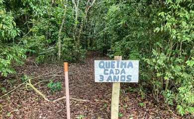
The MapBiomas coordinator notes that most of the burned native vegetation remains unoccupied by humans. "Only a small percentage of the affected areas are primarily pastureland," she says.
Nearly half (46%) of the burned area is concentrated in three states: Mato Grosso, Pará, and Maranhão. Of every 100 hectares burned, 60 are on private land. The three municipalities with the highest burn rates between 1985 and 2023 were Corumbá (Mato Grosso do Sul) in the Pantanal biome, followed by São Felix do Xingu (Pará) in the Amazon biome, and Formosa do Rio Preto (Bahia) in the Cerrado biome.
The MapBiomas survey also indicates that approximately 65 percent of the area affected by fire experienced repeated burning between 1985 and 2023. Over this period, an average of 18.3 million hectares were affected by fire each year.
Biomes
Researcher Ane Alencar warns that although the Cerrado is more adapted to fires, the high frequency of fires weakens the ecosystem. The Cerrado, which has savannah characteristics, with low vegetation, has been significantly affected, with 44 percent of the total area burned at least once in the country located in this biome. This amounts to 88.5 million hectares, nearly half (44%) of the Cerrado's land area.
"It's much more difficult to stop the fire," she explains. "During its peak intensity, especially with strong winds, firefighting becomes impossible."
The Amazon, the second most affected biome, has seen 82.7 million hectares burned at least once, which accounts for a fifth (19.6%) of the Amazon biome.
Born in Pará and a specialist in the Amazon region, Ane Alencar warns of the significant threat that fires pose to forests.
"Forest formations are not adapted to fire; they are sensitive," she explains. "Once burned, the recovery process is very slow, leaving these areas highly susceptible to a second fire. This leads to a degradation process," she adds.
The biome most affected in proportion to its area was the Pantanal, with 9 million hectares burned. While this constitutes only 4.5 percent of the national total, it represents 59.2 percent of the Pantanal biome. Despite being adapted to fire, the Pantanal experiences intense fires, primarily due to prolonged droughts.
In addition to damaging the vegetation cover, which alters the environmental balance among other consequences, fires are significant contributors to the greenhouse effect. They release the carbon stored in the biomass into the atmosphere as carbon dioxide (CO²).
Trends
The MapBiomas researcher notes that since the early 2000s, incentives for improved environmental management have helped to control fires. "Deforestation has decreased, and so has the area burned," she explains.
However, according to her, as of 2019, "there has been a significant increase in both deforestation and the area burned."
She adds that in 2023, the increase in fires persisted due to climate change, which led to severe droughts. These conditions contributed to the land becoming more susceptible to the spread of fires.
"What happened in 2023, especially in the Amazon, is that in regions where deforestation decreased, there was also a reduction in fires overall, including burn-offs and wildfires," she notes.
Historical pattern
Ane Alencar believes that the study provides valuable information, such as the historical pattern of fires, which can assist authorities in formulating strategies to prevent, control, and combat fires.
"These data can significantly enhance our understanding of areas at higher risk of fires. They can be used in accountability processes and to monitor whether climate change is indeed contributing to the increase in fires," she explains.
"There are various applications, including mapping prevention actions, enhancing planning, and optimizing investments for better land use," she adds.